A magnitude 4.4 earthquake was confirmed in Tajikistan near the Afghanistan border

 Tajikistan
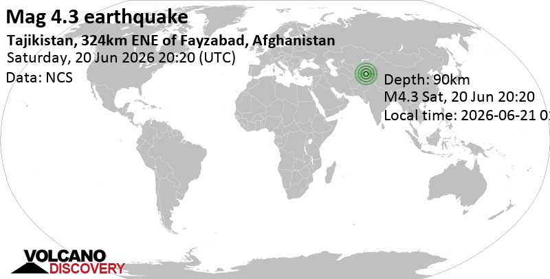
Image: Volcano Discovery
A magnitude 4.4 earthquake struck eastern Tajikistan near the Afghanistan border at 04:30 local time Thursday, releasing accumulated crustal stress along a fault zone that runs parallel to the frontier. Regional seismologists verified the event minutes after detection, placing the epicenter approximately 146 kilometers east-northeast of Fayzabad, Afghanistan.
Emergency coordinators reported zero immediate casualties or structural damage as dawn broke over the mountain terrain. Civil defense teams mobilized from the regional hub of Khorugh to prioritize ground inspections in isolated settlements, where the tremor registered as light to moderate.
Authorities in Afghanistan’s Badakhshan Province activated routine monitoring protocols and confirmed border outposts felt brief shaking but sustained no operational disruptions. Independent monitoring stations across Central Asia logged the seismic signature, independently corroborating initial depth and magnitude readings within standard margins.
Tajikistan’s Ministry of Emergency Situations confirmed that telecommunications networks, power substations, and primary transit routes remain fully functional. Cross-border coordination channels established under regional disaster agreements enabled real-time data sharing, allowing Afghan and Tajik monitoring bureaus to correlate seismic readings instantly.
The quake unfolded along the historically active Pamir-Hindu Kush suture zone. Continental plate convergence has generated centuries of moderate earthquakes here, prompting generations of mountain residents to adopt construction techniques that absorb frequent crustal movement. This historical vulnerability remains a defining factor in regional infrastructure and emergency planning.
Field engineers noted the event’s moderate magnitude and localized intensity align with typical background activity for the sector, significantly reducing the likelihood of secondary hazards. Regional assessment units have been deployed to verify ground stability near critical mountain passes and hydroelectric facilities.
Seismological agencies project rapid stabilization of the local fault system over the next 12 to 24 hours, with perceptible aftershocks deemed highly improbable. Government spokespersons will issue a finalized situational report once vehicular surveys across high-altitude access routes are complete. Citizens are instructed to monitor official emergency frequencies and maintain standard preparedness measures as geological monitoring networks transition back to baseline operational status.